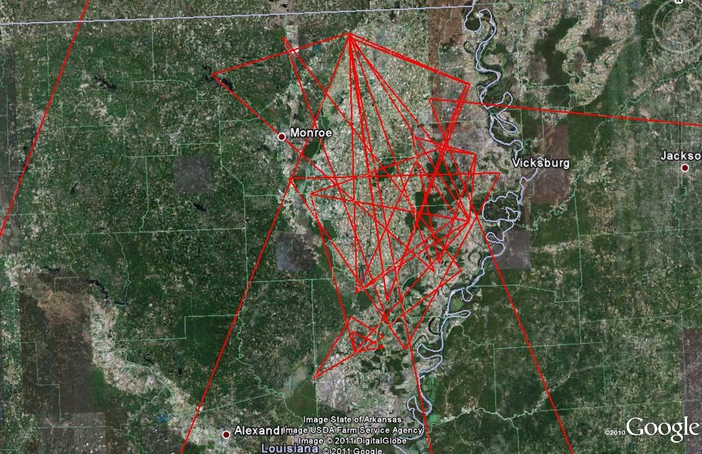
I’ve been working on various versions of my maps for 35 years. I’ve made a variety of computer models, and recently I have started making graphic representations of the results. I thought it would make things easier to decipher. Here’s a sample of one area. not exactly the clarity I was looking for. This is just a sample of the many 30-60-90 and equilateral triangles both within the region and connecting other regions. There are connections with sites in Mexico as well as much further north with other mound areas.
Shapes Everywhere
So what does this have to do with Atlantis? Still too soon to tell. The shapes appear to be chaotic, but I think they may actually be in layers. This makes things even more challenging, since I need to figure out which ones go together and which one’s don’t. It’s further complicated by the fact that some of the patterns are so large, you can’t actually see them because of the curvature of the Earth. There is no one pattern I wanted to highlight in this picture. I just wanted to show you some of the needles in the haystack.


